Description
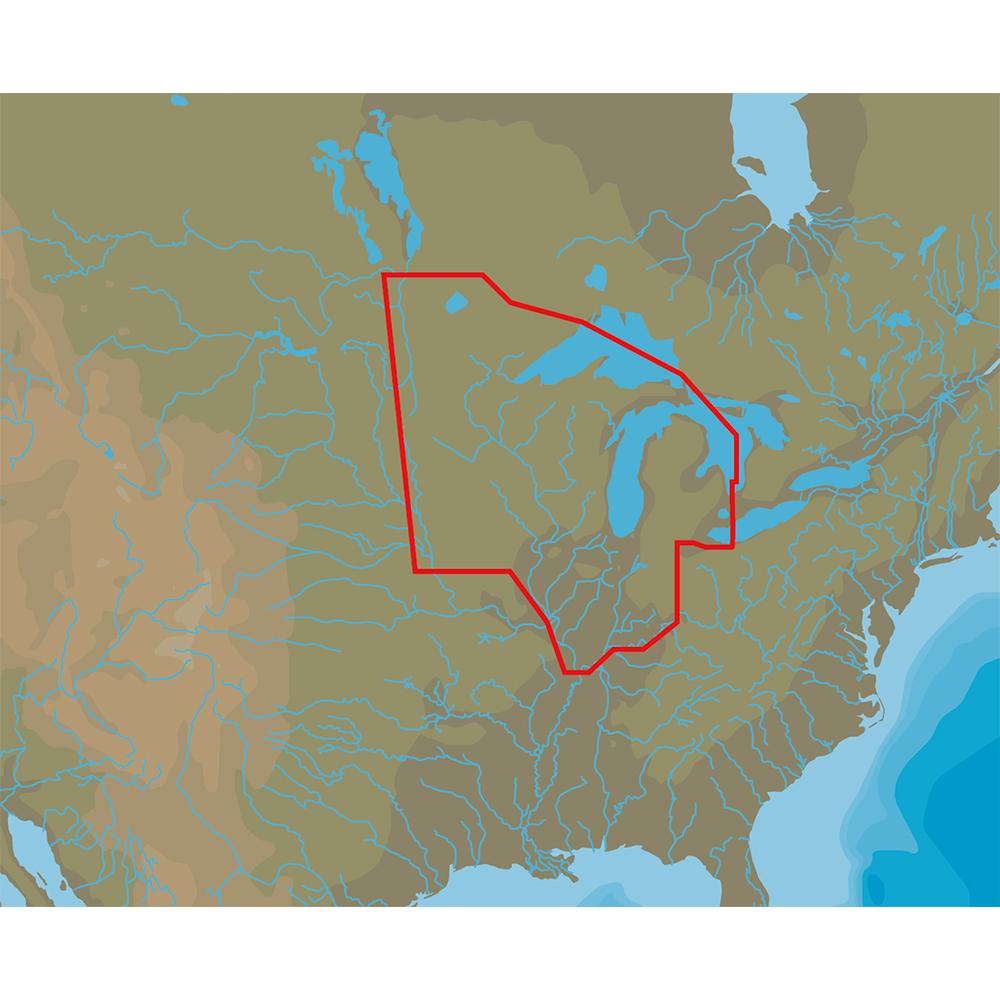
4D Lakes NA-D072 North Central
C-MAP charts have long been held in high regard by boaters because they combine aesthetically pleasing vector electronic charts with reliable sources. When buying C-MAP boaters can be assured that the charts they are getting are of the highest standard.
C-Map 4D will provide boaters with charts packed additional features such as raster chart views or Satellite images* to maximize situational awareness.
Coverage Area:
Lakes and major rivers of North Central region of USA including states of: Minnesota, Wisconsin, Michigan, Iowa, Illinois, Indiana. Includes coverage of Lake Michigan, Lake St. Clair, portions of other Great Lakes.
Manufacturer : C-MAP
Manufacturer Part No : NA-D072