Description
BlueChart® g2 HD with High-Resolution Satellite Imagery – Louisiana Bayou
Coverage
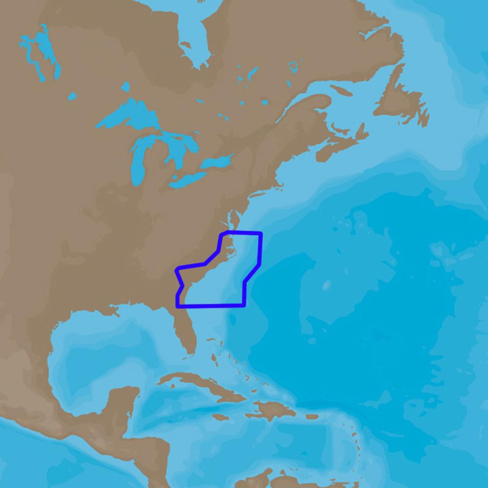
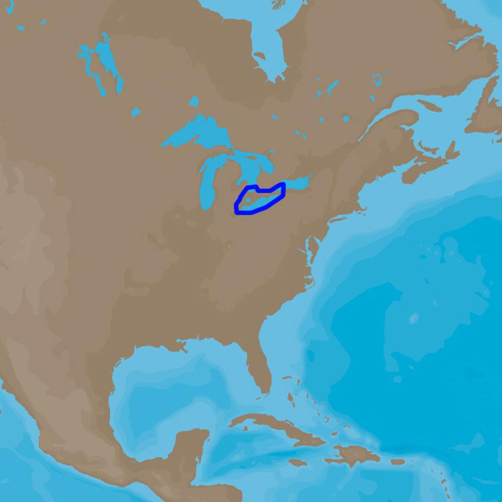
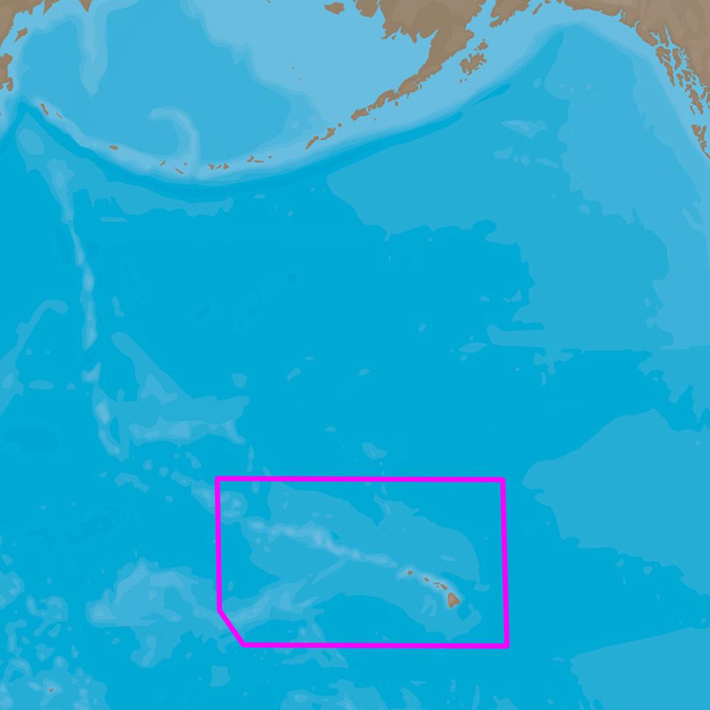
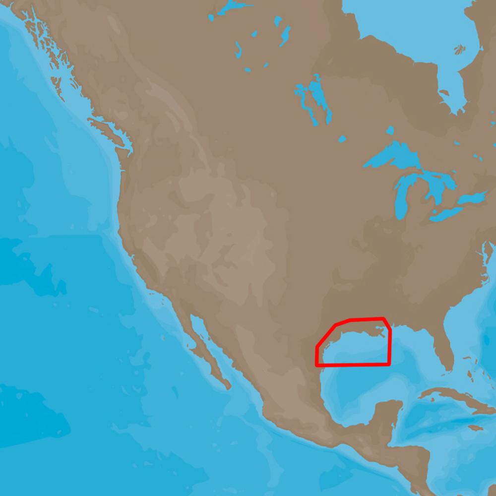
Detailed coverage of the bayou area of Louisiana featuring 1 meter satellite imagery from Calcasieu Lake in the west to Biloxi in the east to Profit Island on the Mississippi River inland. Coverage includes the entire Mississippi River Delta, Lake Pontchartrain, Lake Borgne and the numerous canals and swamps of the area.
Navigate like you were born on the Louisiana Bayou. Combining on-screen navigation with the latest in high-resolution satellite imagery, this mapping product – with complete coverage on a single card – offers clear and current information regarding access to those backwaters, swamps and canals where standard government-issue marine charts may not accurately represent the shifting shorelines of navigable waterways.
- Navigate with a true and realistic "bird’s eye" view of the channels and shorelines in your area by integrating 1 meter high-res color satellite imagery with your chartplotter’s marine cartography.
- Quickly and easily superimpose satellite images over your displayed charts for real-life views of waterways, landmarks, obstructions, terrain features and more.
- View aerials of shorelines, roads, marinas, canals and channels, which help provide the extra situational awareness you need to clearly see the big picture when you’re "up to your armpits in alligators."
- For added perspective, BlueChart g2 HD cartography offers a choice of standard 2-D direct overhead or 3-D "over-the-bow" map views to further enhance chart interpretation and orientation.
Product : GARMIN BLUECHART G2 W/HIGH-RES SATELLITE IMAGERY- LOUISIANA
Manufacturer : GARMIN
Manufacturer Part No : 010-C1121-20
UPC : 753759137595