Description
Platinum+ – US Northeast and Canyons – CF Format
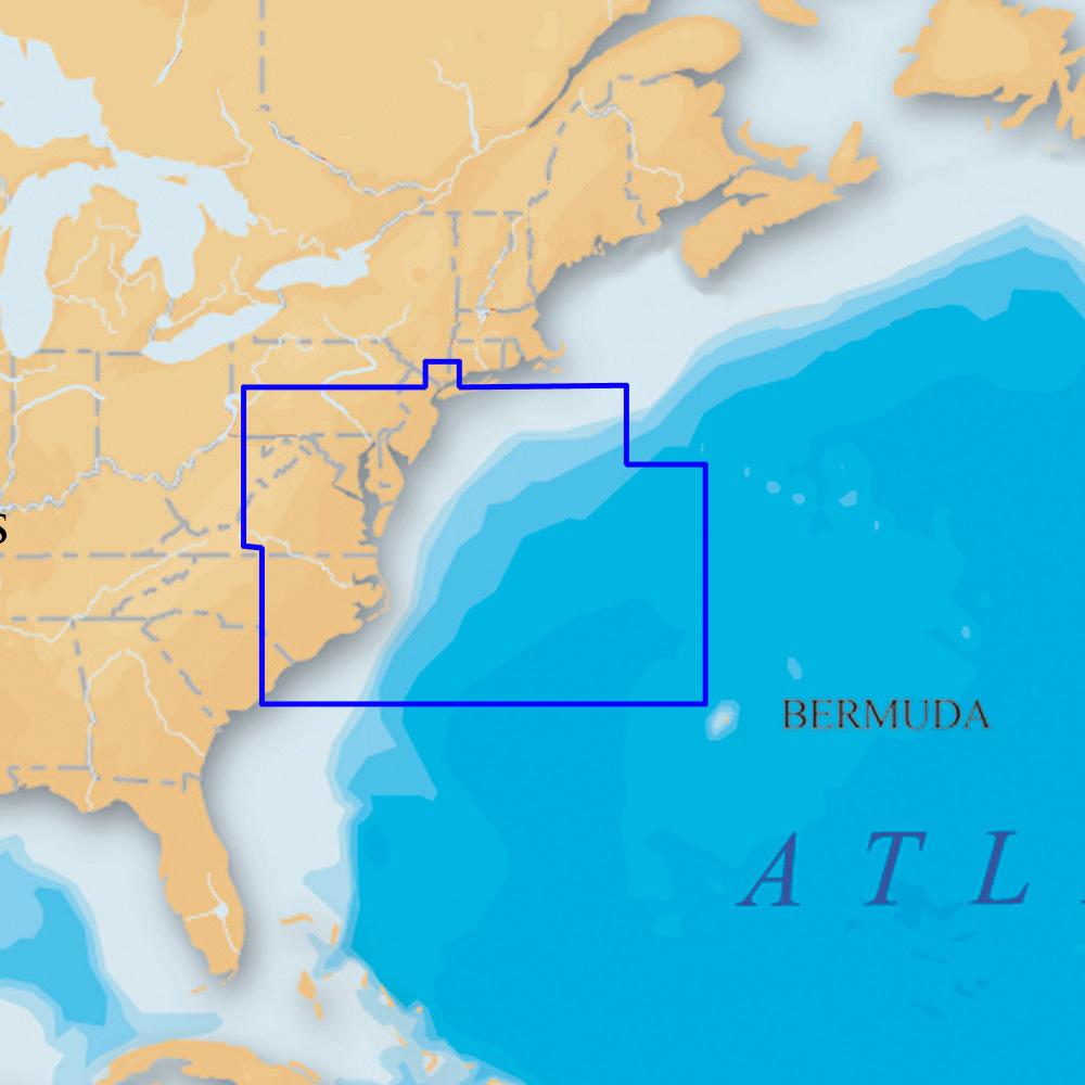
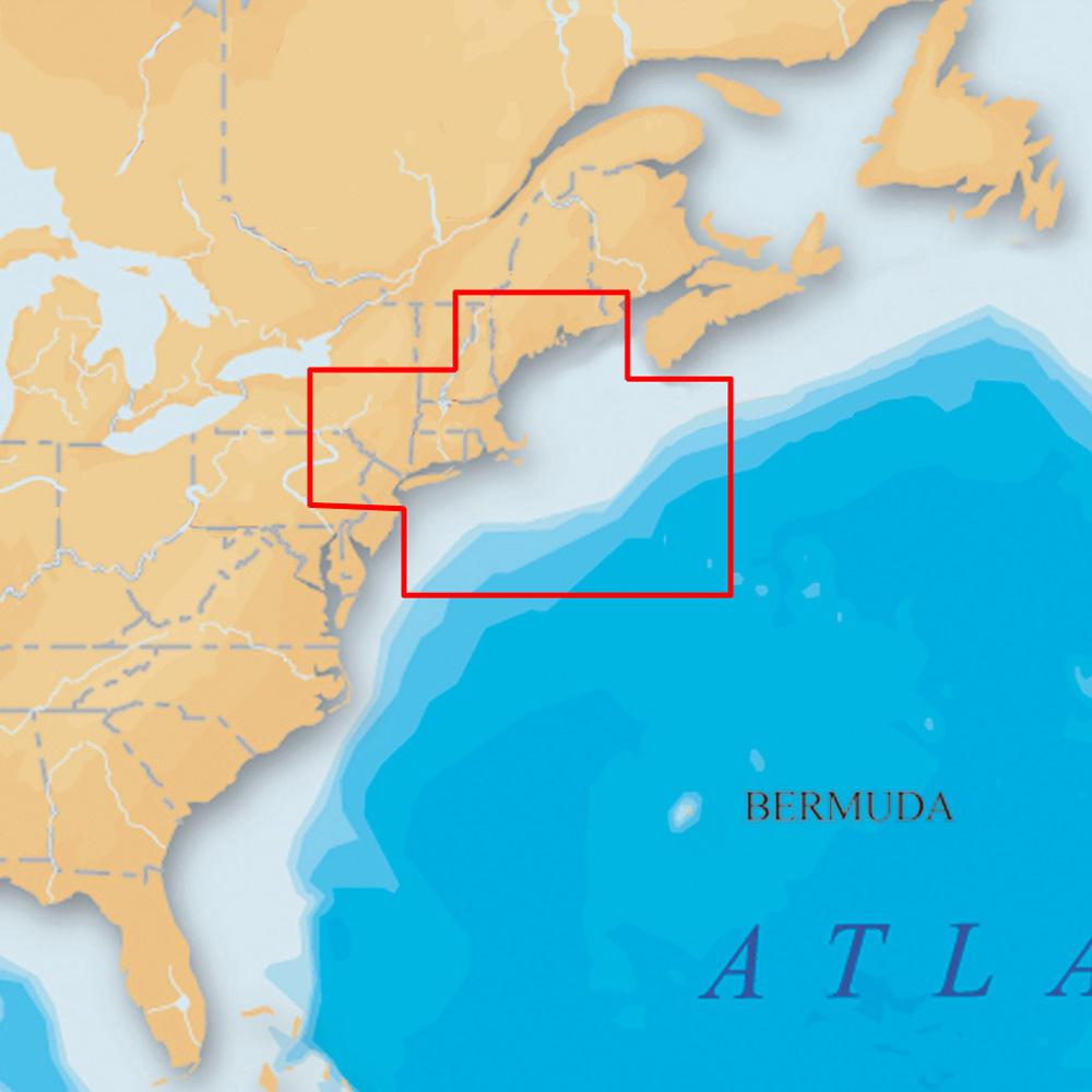
Covers: MAINE, MASSACHUSETTS, NEW YORK, HUDSON RIVER, NORTH ATLANTIC CANYONS From Passamaquoddy Bay and Grand Manan Island to Shark River Inlet, including Hudson River to New York State Barge Canal to Lake Ontario, Oneida Lake, The Finger Lakes, Lake Champlain and bathymetric details of all North Atlantic Canyons from Delaware Bay offshore to Georges Bank and East to 64° West.
Multi-dimensional marine charts include comprehensive Nautical Chart, incredible fishing detail with SonarChart™ 1 ft HD bathymetry map, and Community Edits. Plus, exclusive Platinum features take the boating experience to a whole new level: 3D view, high-resolution photo/chart overlay, port photos, and geo-referenced coast pilots. Register online for one year of daily updates to Nautical Chart, SonarChart and Community Edits.
- One Foot Contours Inshore and Nearshore
- 3ft and 6ft Contours Offshore Beyond 90ft
- 3D View
- Satellite Overlay
- Port Photos
- SonarChart
- Tides & Currents
- Safety Depth Contours, Navaids
- Coastal Points-Of-Interest
- Port Services Information
Visit Navionics.com/downloads-updates to enjoy preloaded content and download the latest charts.
Enhance SonarChart™ with sonar logs you collect using a plotter or mobile device.
High-definition fishing detail, 3D View, Satellite overlay, port photos, tides & currents, safety depth contours, navaids, coastal points of interest, and port services information.
Check compatibility at Navionics.com, which is continuously updated.
Product : NAVIONICS PLATINUM PLUS US NORTHEAST AND CANYONS CF/904P+
Manufacturer : NAVIONICS
Manufacturer Part No : CF/904P+
UPC : 821245904584